
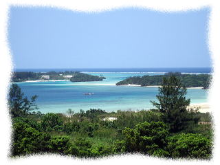
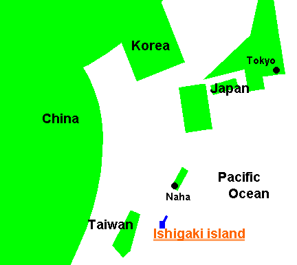
Location
This paradise island that belongs to Japanese Okinawa Prefecture is located
on between 124°5´E and 124°20´E , 24°19´N
and 24°37´N. It is about 1950km far from Tokyo, about 410km far
from Naha (prefectual capital of Okinawa), about 280km far from Taiwan.
Circumference of the island is about 160km, and its dimension is about
230km2, approximately 15% size of Hawaii, Oahu island.
Climate
Ishigaki island, belonging to subtropics, is warm climate around the year.
Its average temperature is around 25°C, highest temperature is around
32°C in August and lowest is around 12°C in January. Annual average
highest and lowest temperature is as follow;
| Jan. | Feb. | Mar. | Apr. | May. | Jun. | Jul. | Aug. | Sep. | Oct. | Nov. | Dec. | |
|---|---|---|---|---|---|---|---|---|---|---|---|---|
| Highest temperature | 21°C | 20°C | 24°C | 24°C | 26°C | 30°C | 32°C | 31°C | 30°C | 28°C | 26°C | 22°C |
| Lowest temperature | 16°C | 16°C | 19°C | 19°C | 23°C | 28°C | 28°C | 27°C | 26°C | 24°C | 22°C | 18°C |
| Water temperature | 21°C | 21°C | 22°C | 24°C | 26°C | 28°C | 29°C | 29°C | 28°C | 27°C | 24°C | 22°C |
Population
This desolate island has about 46,000 populations. Many of them, however
I am living in Kabira where it takes about 30 minutes from town by car,
are living in town area. Its density of population, of course you can calculate
easily, is about 200 people par 1km2, compared with about 13,000 people in Tokyo urban area, so its value is
about 1.5%.
Top page Introduction About Ishigaki Underwater Travel hint Diary Question & Comment
![]()
©2005-2008 Satoki Ohira All right reserved